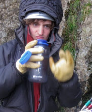
After catching the highway bus down here from Fukuoka and then replacing my broken camera (like I said, long story), I could finally get around to seeing some of the sights in Nagasaki.
The city obviously has huge significance in modern history, being the site of the second atomic bombing (which effectively ended WW2), and so that's what I was mainly here to see. As with Hiroshima, I'll just post a few photos and let you decide what to think.

The Peace Memorial Park, with Peace Fountain (shaped like angel wings, apparently) leading to the Peace Statue.

The Peace Statue. As I understand it, the 'sturdy physique' represents Humanity's strength. The closed eyes represent prayers for those lost in war. The hand pointing upwards is pointing towards the thread of nuclear war, the hand outstretched points towards peace. The crossed leg represents meditation, and the other leg is poised for action. I may be wrong here, so I'd look it up yourself, but there's a lot of (maybe slightly tenuous) ideas packed into that statue.

The black pillar at the hypocenter the bomb exploded directly overhead this point).

A clock in the museum, stopped at exactly 11:02am by the bomb's detonation. I don't think you were meant to take photos of this, but no-one saw me so I think I got away with it.

One-legged torii gate to a Shinto shrine. The other half was destroyed, but this half remains standing and has been left since then.
The next day brought a substantial journey to visit the site of another disaster, albeit a more natural one. The Unzen area is home to a number of volcanoes, most notably Fugen-dake, and Mt. Heisei Shinzan (literally 'new mountain') which formed during Fugen-dake's eruption between 1990 and 1996.
Better photos can be found online, but this was the view of Mt. Heisei Shinzan from the GEMADUS DOME volcano museum/memorial hall in Shimabara town. It is a memorial hall because a pyroclastic flow from here in 1991 killed 44 people in Shimabara (less than the 15,000 it killed in 1792, however).

Note the jagged peak - this is the new lava dome.

Images of the growth of Heisei Shinzan's lava dome.
After obtaining a lot of information from the fascinating (and very 'Japanese' - something that you really have to see for yourself to understand) museum, the next day brought a trip to the town of Unzen, on the other side of Fugen-dake, with the hope of a closer look at the new mountain.
Unzen is a hot spring resort, and is full of geothermal features (vents, mud-pots, etc). Each area is referred to as a 'Jigoku' ('Hell') and has a different name, usually related to a tale that supposedly occurred there, or a feature of the vent (such as it making a screeching noise). I can't remember the names of, well, any of them, but here are 2 photos anyway.


After walking around the various Jigoku, I worked on getting as close to Heisei Shizan as I could given my limited time. Being a beautiful day with barely a cloud in sight, I should get a wonderful view of the lava dome at the summit.
The first step was to catch a minibus up the 'Nita Pass', followed by a cable-car to a point near the summit of Myoken-dake, nearby.

View down the cable-car from the station near the top of Myoken-dake.
From here it was a short walk to the peak of Myoken-dake, and a longer walk (which I didn't have anywhere near enough time for) to the peak of Fugen-dake, which commands excellent views of Heisei Shinzan.
Sadly, as I approached, the weather closed in. A lot.
Regardless, I got occasional fleeting glimpses of the peak, and from points on the way up, as well as at the very peak of Myoken-dake, there were some good views.

The side of Heisei Shinzan, showing path of lahar (volcanic mudflow) and pyroclastic flow. The lumpy rock on the right side of the mountain is the bottom edge of the new dome, but all above it is shrouded in cloud.

The paths of the pyroclastic flows that hit Shimabara are clearly visible here (along with Shimabara at the bottom). Note the concrete barriers erected leading up to the town - these are part of the new defences aimed at controlling the flow of lahars and preventing them from destroying more property.

The shrine near the summit of Myoken-dake, shrouded in cloud.

The view out to Tachibana Bay, showing an even larger volcano. You probably can't see it, so let me point it out (badly)...

The whole edge of the bay forms a roughly circular shape. The huge caldera (crater) here collapsed and was flooded to form the bay.
Anyway, tomorrow I leave Nagasaki and head to Kagoshima for a view of...another active volcano. Mt. Sakurajima is just across the strait from the city, and still occasionally showers the city with ash (to which the residents respond with umbrellas). Hopefully I'll have another update, and more photos, soon.
James